Every day people drive, walk, park, pick up and drop off passengers on the roads of our cities. The environment around us is composed of various road assets: road markings, parking spaces, street lights, sidewalks, curbs, etc. Road planning is designed according to many purposes: for example, special lanes are designed for buses and other large vehicles, while taxi stands are designed to reduce the amount of traffic congestion it causes.
In order to meet the demands and solve compelling problems, municipal departments need to understand traffic data in order to develop and improve the design and construction of roads. The process may be slow and costly, however, because every decision requires thousands of data to support it.
Due to the development of new ways of mobility in recent years, the scope of these issues has only expanded.
New Mobility Brings New Challenges
Driving and public transportation have always been the most common ways to travel. However, with the development of new mobility technology, ride-sharing companies such as Uber and Lyft have provided alternative ways of transportation that are cost-effective and efficient. According to Lyft, 250k passengers gave up driving their own vehicles in 2017.
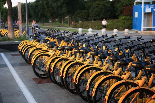
In the past two years, hundreds of brands of docked and dockless bikes, and e-scooters have entered the market. Bird is one of them, and its valuation has reached 2 billion. In order to comply with the sudden large-scale changes in the market, the government has begun to pay attention to the re-planning of sidewalks.
While autonomous vehicles seem distant in the future, several companies in California have started to employ self-driving vehicles to provide services. Walmart cooperates with an AV startup called Udelv to deliver orders and parts to customers.
Fact is, municipalities are relying on road policies and facilities to guide people's behavior. Without data inventory of infrastructure or an effective systematic way to collect them, governments’ solutions will remain passive and insufficient.
Several different road assets are often used at a time to solve problems, however, each road asset is likely owned by different government institutions or even by a third-party company. If the parking department wants to know on-street parking regulations, they need to consider parking signs, fire hydrants, bus stops, etc. Thus, it is almost impossible to obtain all the data needed.
The Truth Is: Governments Remain Stagnant Because Current Data Collection Methods Cost Too Much Time and Money.
Traditionally, cities have had to hire people to conduct field studies and draw maps of streets in order to collect roadside assets. Alternatively, companies and municipalities have employed mapping vehicles to drive around the city to collect such data. Both methods are costly and time-consuming.
For example, some cities in the United States have hired engineering teams to do field studies, and it may take up to two years to collect just the images and locations of the road signs. In order to use such data, it is necessary to conduct post-processing to digitize data. Besides, training humans for manual research is also likely to lead to many errors that cannot be identified.
Another method to collect data on road assets involves using high-priced equipment, which is placed on vehicles. Deep recognition and computer vision are then used to extract the sign information, and 3D reconstruction is employed to obtain their geographical location. Such an approach is costly and complex as post-processing is again required for such massive data.
A Time and Money Saving Method That Can Help Cities Collect Large-scale Data
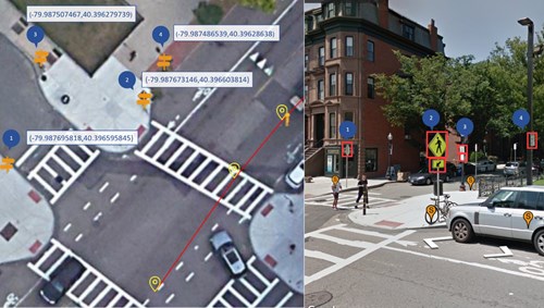
PolaGIS leverages deep learning and computer vision to measure the specific location of road assets and extract the content attributes in the street-level images.
Street-level imagery is the most comprehensive visual record. Not limited to mapping vehicles, with the popularity of smartphones, people can easily take pictures with GPS locations. Nowadays, even some platforms such as open-source GIS data platforms have pictures that cover most parts of the world. Based on existing data records, tons of valuable information can be provided for cities.

The advantages of our technologies:
- Eliminate the need to invest in high-end mapping equipment.
- Eliminate the need to hire and manage a group of people for field studies.
- Highly automatic procedures replace cumbersome post-processing.
- Accuracy of locations in the 5-50 cm absolute ranges
With our technologies, we can record assets data systematically in a short amount of time for cities as large as Los Angeles.
We are now able to produce data on road assets maturely. Product highlights include:
- Precise positioning for various road assets
- Space-level parking regulations
- Incorporation of existing data sources
- Industry GIS data format is provided
- Directly used in any assets record systems
Road assets data are also important information for understanding street parking rules. The parking rules for each parking space are affected by nearby road assets. Parking signs stipulate the main rules for street parking and restrictions for parking near hydrants and bus stations varies from city to city. We are also working hard to integrate all the information into a user-friendly product.
We can help cities to collect road assets as data inventory for storing, managing, and viewing as needed. There are some additional applications of our products that can benefit cities:
- We provide parking data as inventory for regional research and provide them to relevant departments to aid city planning
- We translate parking sign contents into curb regulation, combining with spatial locations of assets such as parking signs, hydrants, and bus stops.
- Our dataset of curbs and assets can help cities to plan new docking areas or pick-up areas for TNCs, shared bikes, etc.
Our products can help cities alleviate traffic congestion, plan for parking enforcement, manage price for parking, and improve public satisfaction. We can also help HD Maps companies, car companies, and other commercial companies (retail, transportation, etc.).
About PolaGIS Inc.

Headquartered in Boston, Massachusetts, PolaGIS specializes in collecting and providing map data with high accuracy and efficiency. Utilizing deep learning and computer vision, we are able to extract map features from satellite and street-level imagery, informing the development of innovative maps for smart parking and geospatial services for the automotive vehicle industry.


